 vesseltracker.com
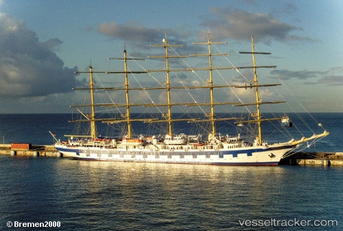
Vessel Royal Clipper IMO: 8712178, MMSI: 215813000 Cruise Ship
UTC, 13.9279, -61.1553, course: 169, speed: 2.2
UTC, 13.8585, -61.165, course: 171, speed: 1.5
2026-02-20 07:39:03 UTC, 13.8316, -61.1863, course: 169, speed: 1.5
Live AIS position:
UTC. 13 nm SW of CUL DESAC),
updated 2026-02-20 07:39:03 UTC.
Find the position of the vessel Royal Clipper on the map. The latter are known coordinates and path.
marine traffic ship tracker show on live map
The current position of vessel Royal Clipper is 13.8316 lat / -61.1863 lng. Updated: 2026-02-20 07:39:03 UTCCurrently sailing under the flag of Malta
Royal Clipper built in 2000 year
Deadweight:
1000 tDetails:
Last coordinates of the vessel:
UTC, 14.0066, -61.1514, course: 175, speed: 5.3UTC, 13.9279, -61.1553, course: 169, speed: 2.2
UTC, 13.8585, -61.165, course: 171, speed: 1.5
2026-02-20 07:39:03 UTC, 13.8316, -61.1863, course: 169, speed: 1.5